ၾၢႆႇ:LocationMauritania.png
ဢမ်ႇမီး ဢၼ်ႁႅင်းၸိုၼ်ႈသႂ်ႇမၼ်း သုင်သုင်
LocationMauritania.png (250 × 115 pixels, တၢင်းလဵၵ်ႉတၢင်းယႂ်ႇ ၾၢႆႇ: 6 KB, ယိူင်ႈ MIME: image/png)
ၵႂၢမ်းယေႃး
| ၶေႃႈသပ်းလႅင်း | ||||
| ဝၼ်းထီႉ | ||||
| ငိူၼ်ႈငဝ်ႈတိုၼ်း | Originally created for English Wikipedia by Vardion. | |||
| ၽူႈတႅမ်ႈလိၵ်ႈ | Vardion | |||
| ၶေႃႈလူတ်းပွႆႇ (ၶိုၼ်းၸႂ်ႉ ၾၢႆႇဢၼ်ၼႆႉ) |
|
|||
| Other versions |
|


ပိုၼ်းၾၢႆႇ
တဵၵ်းၼိူဝ် ဝၼ်းထိ/ၶၢဝ်းယၢမ်း တႃႇႁၼ်ၾၢႆႇ ၼႂ်းဝၼ်းၼၼ်ႉ
| ဝၼ်းထီႉ/ၶၢဝ်းယၢမ်း | ႁၢင်ႈလဵၵ်ႉ | သႅၼ်းမၼ်း | ၽူႈၸႂ်ႉတိုဝ်း | တၢင်းႁၼ်ထိုင် | |
|---|---|---|---|---|---|
| ယၢမ်းလဵဝ် | 14:29, 4 တီႇသႅမ်ႇပႃႇ 2007 | | 250 × 115 (6 KB) | Gandal el gris | Reverted to version as of 07:01, 19 November 2007 |
| 11:29, 4 တီႇသႅမ်ႇပႃႇ 2007 |  | 250 × 115 (5 KB) | Tetouancity | Reverted to version as of 15:01, 14 November 2007 | |
| 07:01, 19 ၼူဝ်ႇဝႅမ်ႇပႃႇ 2007 |  | 250 × 115 (6 KB) | Gandal el gris | ||
| 15:01, 14 ၼူဝ်ႇဝႅမ်ႇပႃႇ 2007 |  | 250 × 115 (5 KB) | Vispec | Reverted to version as of 12:31, 11 November 2007 | |
| 14:34, 12 ၼူဝ်ႇဝႅမ်ႇပႃႇ 2007 |  | 250 × 115 (6 KB) | CHV | Reverted to version as of 18:22, 12 December 2004 | |
| 12:31, 11 ၼူဝ်ႇဝႅမ်ႇပႃႇ 2007 |  | 250 × 115 (5 KB) | Vispec | ||
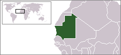
| 18:22, 12 တီႇသႅမ်ႇပႃႇ 2004 |  | 250 × 115 (6 KB) | EugeneZelenko | Location map for the Mauritania.<br/>Originally created for English Wikipedia by Vardion.<br/>{{PD}}<br/>Category:Country locator maps |
လွင်ႈၸႂ်ႉတိုဝ်း ၾၢႆႇ
2 ၼႃႈလိၵ်ႈ ၵွင်ႉမႃးၸူးၾၢႆႇၼႆႉ:
လွင်ႈၸႂ်ႉတိုဝ်းၾၢႆႇလူမ်ႈၽႃႉ
Wikis ၸိူဝ်းဢၼ်ၸႂ်ႉဝႆႉ ၾၢႆႇဢၼ်ၼႆႉ:
- ၸႂ်ႉဝႆႉ arc.wikipedia.org
- ၸႂ်ႉဝႆႉ ar.wikipedia.org
- ၸႂ်ႉဝႆႉ ar.wikinews.org
- ၸႂ်ႉဝႆႉ az.wiktionary.org
- ၸႂ်ႉဝႆႉ bg.wikipedia.org
- ၸႂ်ႉဝႆႉ bm.wikipedia.org
- ၸႂ်ႉဝႆႉ bpy.wikipedia.org
- ၸႂ်ႉဝႆႉ br.wikipedia.org
- ၸႂ်ႉဝႆႉ bs.wikipedia.org
- ၸႂ်ႉဝႆႉ ca.wikinews.org
- ၸႂ်ႉဝႆႉ de.wikinews.org
- ၸႂ်ႉဝႆႉ de.wiktionary.org
- ၸႂ်ႉဝႆႉ en.wikipedia.org
- ၸႂ်ႉဝႆႉ en.wikinews.org
- ၸႂ်ႉဝႆႉ en.wikivoyage.org
- ၸႂ်ႉဝႆႉ en.wiktionary.org
- ၸႂ်ႉဝႆႉ es.wikipedia.org
- ၸႂ်ႉဝႆႉ es.wikinews.org
- ၸႂ်ႉဝႆႉ fr.wikipedia.org
- ၸႂ်ႉဝႆႉ fr.wikinews.org
- ၸႂ်ႉဝႆႉ he.wikivoyage.org
- ၸႂ်ႉဝႆႉ hr.wiktionary.org
တူၺ်း ၾၢႆႇmore global usage ဢၼ်ၼႆႉ